


Ansley Voting District, Hancock County, Mississippi
About
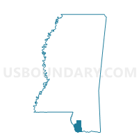
Outline

Summary
| Unique Area Identifier | 605435 |
| Name | Ansley Voting District |
| County | Hancock County |
| State | Mississippi |
| Area (square miles) | 92.50 |
| Land Area (square miles) | 35.07 |
| Water Area (square miles) | 57.43 |
| % of Land Area | 37.92 |
| % of Water Area | 62.08 |
| Latitude of the Internal Point | 30.21437570 |
| Longtitude of the Internal Point | -89.43931360 |
Maps


Graphs
Select a template below for downloading or customizing gragh for Ansley Voting District, Hancock County, Mississippi


Neighbors
Neighoring Voting District (by Name) Neighboring Voting District on the Map
- Voting District 304, Harrison County, MS
- Arlington Voting District, Hancock County, MS
- Clermont Harbor Voting District, Hancock County, MS
- Lakeshore Voting District, Hancock County, MS
- Pearlington Voting District, Hancock County, MS
- Precinct 58, St. Bernard Parish, LA
- Precinct 918, St. Tammany Parish, LA
- South Bay Voting District, Hancock County, MS
- Waveland East Voting District, Hancock County, MS
Top 10 Neighboring County Subdivision (by Population) Neighboring County Subdivision on the Map
- District 3, Harrison County, MS (34,309)
- District 13, St. Tammany Parish, LA (15,501)
- District 2, Hancock County, MS (10,054)
- District E, St. Bernard Parish, LA (7,972)
- District 1, Hancock County, MS (7,179)
- District 4, Hancock County, MS (6,843)
Top 10 Neighboring Place (by Population) Neighboring Place on the Map
Top 10 Neighboring Unified School District (by Population) Neighboring Unified School District on the Map
- St. Tammany Parish School District, LA (233,740)
- Harrison County School District, MS (86,048)
- St. Bernard Parish School District, LA (35,897)
- Hancock County School District, MS (28,715)
- Bay St. Louis School District, MS (14,769)
Top 10 Neighboring State Legislative District Lower Chamber (by Population) Neighboring State Legislative District Lower Chamber on the Map
- State House District 76, LA (50,170)
- State House District 93, MS (28,717)
- State House District 103, LA (23,643)
- State House District 122, MS (20,228)
- State House District 120, MS (19,033)
- State House Districts not defined, LA (0)
Top 10 Neighboring State Legislative District Upper Chamber (by Population) Neighboring State Legislative District Upper Chamber on the Map
- State Senate District 1, LA (89,479)
- State Senate District 46, MS (56,319)
- State Senate Districts not defined, LA (0)
Top 10 Neighboring 111th Congressional District (by Population) Neighboring 111th Congressional District on the Map
- Congressional District 4, MS (754,015)
- Congressional District 1, LA (686,961)
- Congressional District 3, LA (637,371)
Top 10 Neighboring Census Tract (by Population) Neighboring Census Tract on the Map
- Census Tract 407.08, St. Tammany Parish, LA (6,044)
- Census Tract 302, Hancock County, MS (5,768)
- Census Tract 301, Hancock County, MS (4,508)
- Census Tract 304, Hancock County, MS (2,313)
- Census Tract 9900, Harrison County, MS (0)
- Census Tract 9900, Hancock County, MS (0)
- Census Tract 9900, St. Bernard Parish, LA (0)